Venir depuis chez vous
Votre trajet complet jusqu’au camping, à vos dates — depuis une adresse, une ville ou une gare.
VOTRE POINT DE DÉPART POUR DÉCONNECTER
Mandelieu-la-Napoule · Alpes-Maritimes · Camping 3 étoiles
À MA PORTÉE
Selon vos critères · 800 m avec bagages · 1,5 km sans bagages · bus direct
POSER SES VALISES
À pied de l’arrêt. Un arrêt tout près. Une gare voyageurs recensée. Des départs le dimanche aussi. Arrêt Cimetière de la Napoule à 270 m (4 min à pied), gare de Mandelieu-la-Napoule à 1,2 km.
Classement Atout France du 24/05/2022.
01 · VENIR AU CAMPING
Votre trajet complet jusqu’au camping, à vos dates — depuis une adresse, une ville ou une gare.
02 · VIVRE AU QUOTIDIEN
Au moins une adresse facile pour chaque besoin choisi. Ouvrez une catégorie pour comparer les lieux et leurs trajets.
03 · EXPLORER LES ENVIRONS
Piochez les idées qui vous plaisent. Chaque accès est évalué selon vos critères, depuis le camping.
13 idées autour du camping · 3 faciles selon vos critères
La Plage du Château est une plage publique située entre port La Napoule et le Château. Source : DATAtourisme.
24 min à pied
1,6 km de marche
Avenue du Général De Gaulle, 06210 Mandelieu-la-Napoule
La Plage de la Raguette est une plage publique. Située en bord de route, dans le quartier de la Napoule. Source : DATAtourisme.
16 min à pied
1 km de marche
Accès par la route départementale 6098, puis la rue de la plage., 06210 Mandelieu-la-Napoule
4 courts en terre battue, 1 court synthétique (3 éclairés), 1 terrain de beach-tennis, 1 Club House avec salle de fitness et piscine. Ecole de tennis à partir de 5 ans. Ecole de compétition à partir de 8 ans. Baby sport à partir de 3 ans. Source : DATAtourisme.
25 min à pied
1,6 km de marche
26 Chemin de Maure-Vieil, 06210 Mandelieu-la-Napoule
La Plage de la Raguette est une plage publique. Située en bord de route, dans le quartier de la Napoule. Source : DATAtourisme.
16 min à pied
1 km de marche
Accès par la route départementale 6098, puis la rue de la plage., 06210 Mandelieu-la-Napoule
150 postes intégralement dévolus aux bateaux à moteur. Source : DATAtourisme.
25 min à pied
1,7 km de marche
06210 Mandelieu-la-Napoule
La Plage du Château est une plage publique située entre port La Napoule et le Château. Source : DATAtourisme.
19 min à pied
1,3 km de marche
Avenue du Général De Gaulle, 06210 Mandelieu-la-Napoule
Situé en centre ville le Centre Expo Congrès est le lieu idéal pour l’organisation de congrès de 200 à 1000 personnes, soirée de Gala jusqu’à 1 500 personnes en diner servi et 3500 personnes en cocktail dinatoire. Source : DATAtourisme.
46 min à pied
3 km de marche
836, boulevard des écureuils, 06210 Mandelieu-la-Napoule
La Plage Fon Marina est une plage publique. Située en bord de route, à proximité du quartier de la Napoule. Source : DATAtourisme.
32 min à pied
2,1 km de marche
Avenue du Général De Gaulle, 06210 Mandelieu-la-Napoule
Port Inland est un port de plaisance à sec d’une capacité de 800 places qui accueille au mois ou à l’année des bateaux à moteur jusqu’à 5 tonnes. Source : DATAtourisme.
50 min à pied
3,3 km de marche (passe par un bac)
BP 3055, 06210 Mandelieu-la-Napoule
La Plage de Robinson est une plage publique. Située en bord de route, à proximité du quartier de la Napoule. Source : DATAtourisme.
33 min à pied
2,2 km de marche
Avenue du Général De Gaulle, 06210 Mandelieu-la-Napoule
La Plage du Sable d'Or est une plage publique. Située en bord de route, à proximité du quartier de la Napoule. Source : DATAtourisme.
36 min à pied
2,4 km de marche
Avenue du Général De Gaulle, 06210 Mandelieu-la-Napoule
La Plage des Dauphins est une plage publique. Située en bord de route, à proximité du quartier de la Napoule. Source : DATAtourisme.
40 min à pied
2,6 km de marche
Avenue du Général De Gaulle, 06210 Mandelieu-la-Napoule
Bien à l'abri de la population, après une descente sur un chemin ombragé, à vous la discrétion et la tranquillité, entourés de roches rouges et de plantes méditerranéennes Source : DATAtourisme.
45 min · bus direct
2,5 km de marche
À pied : 114 min · 7,6 km
Pointe Notre Dame, 83702 Saint-Raphaël
La carte se dessine quand vous l’ouvrez.
Positions issues d’OpenStreetMap, de DATAtourisme et de l’ARS. Les lieux évalués prennent la couleur de leur accès selon vos critères ; les autres restent en bleu marine, sans niveau. Choisissez un lieu pour ouvrir ses informations. Les arrêts et les lignes de transport viennent des horaires publiés par les réseaux (GTFS) ; choisissez un arrêt pour voir ses départs à une date. Un tracé plein est celui publié par le réseau ; en pointillés, les arrêts sont seulement reliés en ligne droite, le tracé n’est pas publié.
Vos limites de déplacement restent inchangées.
6 expériences sur 50, prix relevés le 15 octobre 2026
Jusqu’au centre-ville : 54 min en car et à pied le mardi 20 octobre 2026, départ du camping à 9 h 03 (1 correspondance, 877 m de marche) ; dernier retour à 17 h 56.
 Croisière / Navigation / Sunset aux iles de Lerins4,9 ★ · 203 avis · 3 h 30 · dès 130 €
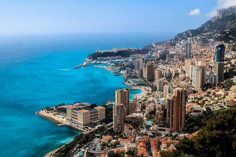 Visite privée d'une demi-journée à Eze et Monaco5,0 ★ · 173 avis · 5 h · dès 670 €
 Viste authentique de Cannes en Van Vintage5,0 ★ · 153 avis · 2 h · dès 75 €
 Excursion d'une journée en petit groupe à Monaco et Eze, au départ de Cannes4,8 ★ · 130 avis · 10 h · dès 131 €
 Goûter Cannes – Une visite gastronomique complète de la Côte d’Azur par Do Eat Better4,9 ★ · 121 avis · 3 h 30 · dès 95 €
 Excursion En Bateau Privé Cannes Îles De Lérins5,0 ★ · 103 avis · 4 h 30 · dès 290 €
Liens de réservation affiliés (Viator) : si vous réservez, une commission peut être perçue, sans surcoût pour vous. Prix, disponibilités et réservation sur le site du partenaire.
6 expériences, prix relevés le 15 octobre 2026
 Cannes : Au-delà du tapis rouge5,0 ★ · 1 avis · 3 h · dès 79 €
 Cannes historique : Visite privée exclusive avec un habitant5,0 ★ · 1 avis · 2 h · dès 128 €
 Cannes Visite audioguidée à pied 1h50 et 19 commentaires audios3,0 ★ · 3 avis · 1 h 50 · dès 6 €
 Cannes Visite à pied de la vieille ville au port et au festival du film3 h · dès 60 €
 Visite culturelle privée personnalisable à Cannes3 h · dès 416 €
 Vues panoramiques et séance photo sur la plage à Cannes30 min · dès 79 €
Liens de réservation affiliés (Viator) : si vous réservez, une commission peut être perçue, sans surcoût pour vous. Prix, disponibilités et réservation sur le site du partenaire.
49 min en car et à pied le mardi 20 octobre 2026, départ du camping à 9 h 03 (1 correspondance, 589 m de marche) ; dernier retour à 18 h 01.
6 expériences sur 10, prix relevés le 15 octobre 2026
Viste authentique de Cannes en Van Vintage5,0 ★ · 153 avis · 2 h · dès 75 € CannesVisiTour, Grand Tour: 2 Heures4,8 ★ · 38 avis · 2 h · dès 54 €
 Séance photo privée avec un photographe professionnel à Cannes5,0 ★ · 2 avis · 1 h · dès 259 €
 Cannes Private Photoshoot dans le front de mer, le port et la vieille ville5,0 ★ · 2 avis · 30 min · dès 79 €
 Expérience viticole exclusive de Saint-Honorat Monk de Cannes5,0 ★ · 1 avis · 4 h · dès 644 €Cannes : Au-delà du tapis rouge5,0 ★ · 1 avis · 3 h · dès 79 €
Liens de réservation affiliés (Viator) : si vous réservez, une commission peut être perçue, sans surcoût pour vous. Prix, disponibilités et réservation sur le site du partenaire.
49 min en car et à pied le mardi 20 octobre 2026, départ du camping à 9 h 03 (1 correspondance, 585 m de marche) ; dernier retour à 18 h 01.
6 expériences sur 7, prix relevés le 15 octobre 2026
CannesVisiTour, Grand Tour: 2 Heures4,8 ★ · 38 avis · 2 h · dès 54 € Excursion privée d'une journée sur mesure à Cannes4,8 ★ · 18 avis · 8 h · dès 1150 €
 Excursion pour escale à Cannes : visite privée de la Côte d'Azur4,6 ★ · 55 avis · 8 h · dès 850 €
 Goût de Cannes : Visite gastronomique provençale, vin et fromage3,7 ★ · 3 avis · 3 h · dès 143 €
 Visite privée d'une journée et excursion à terre à Nice, Eze et Monaco8 h · dès 1139 €Cannes Visite à pied de la vieille ville au port et au festival du film3 h · dès 60 €
Liens de réservation affiliés (Viator) : si vous réservez, une commission peut être perçue, sans surcoût pour vous. Prix, disponibilités et réservation sur le site du partenaire.
51 min en car et à pied le mardi 20 octobre 2026, départ du camping à 9 h 03 (1 correspondance, 704 m de marche) ; dernier retour à 17 h 59.
6 expériences sur 10, prix relevés le 15 octobre 2026
Viste authentique de Cannes en Van Vintage5,0 ★ · 153 avis · 2 h · dès 75 € Excursion privée d'une journée complète à Cannes : Èze et Monaco5,0 ★ · 14 avis · 8 h · dès 1100 €
 Le meilleur de la Côte d'Azur en une journée - Cannes, Antibes, Nice, Eze, Monaco5,0 ★ · 3 avis · 8 h · dès 1108 €
 Les temps forts de Cannes: Une visite audio autoguidée5,0 ★ · 2 avis · 1 h 15 · dès 11 €Séance photo privée avec un photographe professionnel à Cannes5,0 ★ · 2 avis · 1 h · dès 259 €Cannes Private Photoshoot dans le front de mer, le port et la vieille ville5,0 ★ · 2 avis · 30 min · dès 79 €
Liens de réservation affiliés (Viator) : si vous réservez, une commission peut être perçue, sans surcoût pour vous. Prix, disponibilités et réservation sur le site du partenaire.
52 min en car et à pied le mardi 20 octobre 2026, départ du camping à 9 h 03 (1 correspondance, 439 m de marche) ; dernier retour à 18 h 03.
6 expériences sur 10, prix relevés le 15 octobre 2026
 Yacht Me Up All Inclusive Private Cruise Cannes Lérins Sailing5,0 ★ · 228 avis · 4 h · dès 494 €Viste authentique de Cannes en Van Vintage5,0 ★ · 153 avis · 2 h · dès 75 €CannesVisiTour, Grand Tour: 2 Heures4,8 ★ · 38 avis · 2 h · dès 54 €
 Excursion à Cannes sur la rive privée: visite de la Côte d'Azur & Monaco5,0 ★ · 20 avis · 7 h 30 · dès 856 €Séance photo privée avec un photographe professionnel à Cannes5,0 ★ · 2 avis · 1 h · dès 259 €Cannes Private Photoshoot dans le front de mer, le port et la vieille ville5,0 ★ · 2 avis · 30 min · dès 79 €
Liens de réservation affiliés (Viator) : si vous réservez, une commission peut être perçue, sans surcoût pour vous. Prix, disponibilités et réservation sur le site du partenaire.
54 min en car et à pied le mardi 20 octobre 2026, départ du camping à 9 h 03 (1 correspondance, 558 m de marche) ; dernier retour à 17 h 59.
6 expériences sur 10, prix relevés le 15 octobre 2026
Excursion En Bateau Privé Cannes Îles De Lérins5,0 ★ · 103 avis · 4 h 30 · dès 290 € Excursion privée à la voile & pique-nique provençal5,0 ★ · 72 avis · 5 h 30 · dès 120 €
 Navigation de plaisance classique à Cannes5,0 ★ · 50 avis · 4 h · dès 986 €
 Évasion privée pour découvrir Cannes et les îles de Lérins depuis la mer5,0 ★ · 27 avis · 4 h · dès 410 €
 Cannes Soirée détente aux îles de Lérins Bateau privé5,0 ★ · 27 avis · 3 h · dès 390 €
 Cannes:Private Sea Ray Boat Trip to Lérins Islands Swim & Snorkel5,0 ★ · 23 avis · 4 h · dès 290 €
Liens de réservation affiliés (Viator) : si vous réservez, une commission peut être perçue, sans surcoût pour vous. Prix, disponibilités et réservation sur le site du partenaire.
Aucun trajet en transport public trouvé le mardi 20 octobre 2026 en partant du camping après 9 h.