Venir depuis chez vous
Votre trajet complet jusqu’au camping, à vos dates — depuis une adresse, une ville ou une gare.
VOTRE POINT DE DÉPART POUR DÉCONNECTER
Cannes · Alpes-Maritimes · Camping 4 étoiles
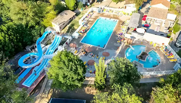
À MA PORTÉE
Selon vos critères · 800 m avec bagages · 1,5 km sans bagages · bus direct
POSER SES VALISES
À pied de l’arrêt. Un arrêt tout près. Une gare voyageurs recensée. Des départs le dimanche aussi. Arrêt Les Aubépines à 250 m (4 min à pied), gare de Cannes-la-Bocca à 3,0 km.
Classement Atout France du 09/02/2026.
01 · VENIR AU CAMPING
Votre trajet complet jusqu’au camping, à vos dates — depuis une adresse, une ville ou une gare.
02 · VIVRE AU QUOTIDIEN
Au moins une adresse facile pour chaque besoin choisi. Ouvrez une catégorie pour comparer les lieux et leurs trajets.
03 · EXPLORER LES ENVIRONS
Piochez les idées qui vous plaisent. Chaque accès est évalué selon vos critères, depuis le camping.
34 idées autour du camping · 0 facile selon vos critères
Gour de Coule, un espace boisé pour se reconnecter à la nature... Source : DATAtourisme.
42 min à pied
2,8 km de marche
Gour de Coule, 06110 Le Cannet
Un environnement protégé Tout en ayant un petit air de nature sauvage, le site est placé sous la haute surveillance du service des espaces verts municipaux. On y a répertorié 120 espèces végétales, des plantes autochtones dont 12 espèces d'arbres. Source : DATAtourisme.
36 min · bus direct
2,2 km de marche
À pied : 41 min · 2,7 km
Allée Dany Bernard, 06110 Le Cannet
La famille Orso, vous accueille sur l'exploitation Arboricole (Pêche, fraises). 15 Hectares de fruits, pêche, fraisier, maraichage. Depuis 3 générations Source : DATAtourisme.
31 min à pied
2,1 km de marche
712 avenue Jean Mermos, 06210 Mandelieu-la-Napoule
Club d'escalade et de canyon, Val de Siagne. Accueille petits et grands, débutants et confirmés. Entraînements en salle, sorties falaises et canyon. Source : DATAtourisme.
47 min · bus direct
2,4 km de marche
À pied : 81 min · 5,4 km
Gymnase du Collège Arnaud Beltrame, 06580 Pégomas
La visite de ces forts, patrimoine maralpin exceptionnel, vous permettra de mieux connaitre l’histoire mouvementée de notre territoire. Source : DATAtourisme.
41 min · bus direct
2 km de marche
À pied : 78 min · 5,2 km
Quai Laubeuf, 06400 Cannes
"Dès le début du XXe, ce quartier connaît un fort essor démographique. Une situation qui interpelle le clergé : « (...) ce vrai village qui se forme ne peut jouir d'aucun secours religieux » Source : DATAtourisme.
45 min · bus direct
2,6 km de marche
À pied : 71 min · 4,7 km
1 Place Maréchal Foch, 06110 Le Cannet
Les Ecuries des Veys propose un programme de stages ainsi que de cours complets, centré sur l'apprentissage par l'expérience, l'attention et la réflexion. Source : DATAtourisme.
51 min · bus direct
2,7 km de marche
À pied : 72 min · 4,8 km
2075, avenue de la République, 06580 Pégomas
La Plage de Robinson est une plage publique. Située en bord de route, à proximité du quartier de la Napoule. Source : DATAtourisme.
46 min · bus direct
2,9 km de marche
À pied : 52 min · 3,5 km
Avenue du Général De Gaulle, 06210 Mandelieu-la-Napoule
L’ECSVS est un équipement culturel et sportif intercommunal dotant le secteur de la Vallée de la Siagne d’une structure adaptée pour recevoir des évènements de moyenne importance et couvrant les besoins de la population. Source : DATAtourisme.
51 min · bus direct
2,9 km de marche
À pied : 70 min · 4,7 km
1975 Avenue de la République, 06550 La Roquette-sur-Siagne
Un plateau multisports de 3300 m2 accueille les sportifs avenue Georges Pompidou, à l'Aubarède. Source : DATAtourisme.
47 min à pied
3,1 km de marche
Avenue Georges Pompidou, 06110 Le Cannet
La Plage du Château est une plage publique située entre port La Napoule et le Château. Source : DATAtourisme.
46 min · bus direct
2,8 km de marche
À pied : 69 min · 4,6 km
Avenue du Général De Gaulle, 06210 Mandelieu-la-Napoule
Atelier de créations artisanales. Restauration de petits mobiliers et objets de déco. Upcycling de type brocante. Photographe- Portraitiste Source : DATAtourisme.
112 min à pied
7,5 km de marche
650 chemin des Plaines, 83440 Tanneron
Un plateau multisports de 3300 m2 accueille les sportifs avenue Georges Pompidou, à l'Aubarède. Source : DATAtourisme.
48 min à pied
3,2 km de marche
Avenue Georges Pompidou, 06110 Le Cannet
La Plage de la Raguette est une plage publique. Située en bord de route, dans le quartier de la Napoule. Source : DATAtourisme.
46 min · bus direct
2,7 km de marche
À pied : 73 min · 4,9 km
Accès par la route départementale 6098, puis la rue de la plage., 06210 Mandelieu-la-Napoule
Fabrication artisanale de robes en tulle et décorations diverses Source : DATAtourisme.
123 min à pied
8,2 km de marche
61 ancien chemin de Mieran - Les Plaines, 83440 Tanneron
Le Skatepark de Mouans-Sartoux est situé en coeur de ville, à proximité du cinéma et de la gare. Source : DATAtourisme.
58 min à pied
3,9 km de marche
Ecole Aimé Legall, 06370 Mouans-Sartoux
La Plage de la Raguette est une plage publique. Située en bord de route, dans le quartier de la Napoule. Source : DATAtourisme.
46 min · bus direct
2,7 km de marche
À pied : 73 min · 4,9 km
Accès par la route départementale 6098, puis la rue de la plage., 06210 Mandelieu-la-Napoule
Votre studio Iron Bodyfit vous propose des séance d’électrostimulation musculaire (EMS), une méthode innovante pour améliorer sa condition physique, perdre du poids, tonifier son corps et renforcer ses muscles en un minimum de temps. Source : DATAtourisme.
58 min à pied
3,9 km de marche
ZAC des Mimosas, Place Pierre Sauvaigo, 06110 Le Cannet
La Plage des Dauphins est une plage publique. Située en bord de route, à proximité du quartier de la Napoule. Source : DATAtourisme.
46 min à pied
3,1 km de marche
Avenue du Général De Gaulle, 06210 Mandelieu-la-Napoule
Situé en centre ville le Centre Expo Congrès est le lieu idéal pour l’organisation de congrès de 200 à 1000 personnes, soirée de Gala jusqu’à 1 500 personnes en diner servi et 3500 personnes en cocktail dinatoire. Source : DATAtourisme.
59 min à pied
3,9 km de marche
836, boulevard des écureuils, 06210 Mandelieu-la-Napoule
La Plage du Sable d'Or est une plage publique. Située en bord de route, à proximité du quartier de la Napoule. Source : DATAtourisme.
48 min · bus direct
3,1 km de marche
À pied : 50 min · 3,3 km
Avenue du Général De Gaulle, 06210 Mandelieu-la-Napoule
En partenariat avec la marque de renom française Cinq Mondes, notre spa vous invite à vous détendre et à profiter de nos soins et massages ancestraux. Une ode au raffinement et à la douceur pour apaiser et sublimer votre peau et votre âme. Source : DATAtourisme.
61 min à pied
4,1 km de marche
424 Avenue du Roi, 06250 Mougins
La Plage Fon Marina est une plage publique. Située en bord de route, à proximité du quartier de la Napoule. Source : DATAtourisme.
48 min · bus direct
3,1 km de marche
À pied : 62 min · 4,1 km
Avenue du Général De Gaulle, 06210 Mandelieu-la-Napoule
150 postes intégralement dévolus aux bateaux à moteur. Source : DATAtourisme.
62 min à pied
4,1 km de marche
06210 Mandelieu-la-Napoule
Port Inland est un port de plaisance à sec d’une capacité de 800 places qui accueille au mois ou à l’année des bateaux à moteur jusqu’à 5 tonnes. Source : DATAtourisme.
63 min à pied
4,2 km de marche
BP 3055, 06210 Mandelieu-la-Napoule
4 courts en terre battue, 1 court synthétique (3 éclairés), 1 terrain de beach-tennis, 1 Club House avec salle de fitness et piscine. Ecole de tennis à partir de 5 ans. Ecole de compétition à partir de 8 ans. Baby sport à partir de 3 ans. Source : DATAtourisme.
66 min · bus direct
3,7 km de marche
À pied : 104 min · 6,9 km
26 Chemin de Maure-Vieil, 06210 Mandelieu-la-Napoule
Scène55 est le théâtre municipal de la Ville de Mougins : 3 057 m² dédiés à la culture avec un théâtre, une école de musique, des ateliers de pratique artistique, un lieu de résidence dédié à la marionnette. Source : DATAtourisme.
67 min · bus direct
3,7 km de marche
À pied : 79 min · 5,3 km
55, chemin de Faissole, 06250 Mougins
La Plage du Château est une plage publique située entre port La Napoule et le Château. Source : DATAtourisme.
70 min à pied
4,6 km de marche
Avenue du Général De Gaulle, 06210 Mandelieu-la-Napoule
Un Escape Game d’horreur, c’est quoi ? Avez-vous déjà vu un film d’horreur ? Si oui, imaginez vous, ne plus être un simple spectateur, mais bel et bien un acteur de ce film !? Source : DATAtourisme.
76 min à pied
5 km de marche
12 rue des Ecoles, 06110 Le Cannet
Un Escape Game d’horreur, c’est quoi ? Avez-vous déjà vu un film d’horreur ? Si oui, imaginez vous, ne plus être un simple spectateur, mais bel et bien un acteur de ce film !? Source : DATAtourisme.
76 min à pied
5 km de marche
12 rue des Ecoles, 06110 Le Cannet
Après quelques minutes de bateau au départ de Cannes, l'île Sainte- Marguerite vous offre un site exceptionnel où se conjuguent en toute harmonie nature, culture et détente. Source : DATAtourisme.
79 min à pied
5,3 km de marche
Quai Laubeuf - Parking Laubeuf, 06400 Cannes
Licorne Boxing, preparent les futurs champions ! Source : DATAtourisme.
80 min à pied
5,3 km de marche
Gymnase Principiano, avenue Maurice Jeanpierre, 06110 Le Cannet
Brasserie Artisanale, Brewpub, Restaurant Locavore sur La Roquette sur Siagne Source : DATAtourisme.
80 min à pied
5,3 km de marche
85 Promenade Francis Lantéri, 06550 La Roquette-sur-Siagne
La Méditerranée à vélo de Cannes à Nice. Source : DATAtourisme.
83 min à pied
5,6 km de marche
1 Boulevard de la Croisette, 06400 Cannes
La carte se dessine quand vous l’ouvrez.
Positions issues d’OpenStreetMap, de DATAtourisme et de l’ARS. Les lieux évalués prennent la couleur de leur accès selon vos critères ; les autres restent en bleu marine, sans niveau. Choisissez un lieu pour ouvrir ses informations. Les arrêts et les lignes de transport viennent des horaires publiés par les réseaux (GTFS) ; choisissez un arrêt pour voir ses départs à une date. Un tracé plein est celui publié par le réseau ; en pointillés, les arrêts sont seulement reliés en ligne droite, le tracé n’est pas publié.
Vos limites de déplacement restent inchangées.
6 expériences sur 50, prix relevés le 15 octobre 2026
Jusqu’au centre-ville : 43 min en car et à pied le mardi 20 octobre 2026, départ du camping à 9 h 02 (1,1 km de marche) ; dernier retour à 18 h 15.
 Croisière / Navigation / Sunset aux iles de Lerins4,9 ★ · 203 avis · 3 h 30 · dès 130 €
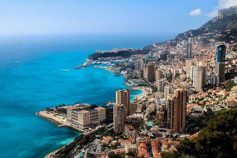 Visite privée d'une demi-journée à Eze et Monaco5,0 ★ · 173 avis · 5 h · dès 670 €
 Viste authentique de Cannes en Van Vintage5,0 ★ · 153 avis · 2 h · dès 75 €
 Excursion d'une journée en petit groupe à Monaco et Eze, au départ de Cannes4,8 ★ · 130 avis · 10 h · dès 131 €
 Goûter Cannes – Une visite gastronomique complète de la Côte d’Azur par Do Eat Better4,9 ★ · 121 avis · 3 h 30 · dès 95 €
 Excursion En Bateau Privé Cannes Îles De Lérins5,0 ★ · 103 avis · 4 h 30 · dès 290 €
Liens de réservation affiliés (Viator) : si vous réservez, une commission peut être perçue, sans surcoût pour vous. Prix, disponibilités et réservation sur le site du partenaire.
6 expériences, prix relevés le 15 octobre 2026
 Cannes : Au-delà du tapis rouge5,0 ★ · 1 avis · 3 h · dès 79 €
 Cannes historique : Visite privée exclusive avec un habitant5,0 ★ · 1 avis · 2 h · dès 128 €
 Cannes Visite audioguidée à pied 1h50 et 19 commentaires audios3,0 ★ · 3 avis · 1 h 50 · dès 6 €
 Cannes Visite à pied de la vieille ville au port et au festival du film3 h · dès 60 €
 Visite culturelle privée personnalisable à Cannes3 h · dès 416 €
 Vues panoramiques et séance photo sur la plage à Cannes30 min · dès 79 €
Liens de réservation affiliés (Viator) : si vous réservez, une commission peut être perçue, sans surcoût pour vous. Prix, disponibilités et réservation sur le site du partenaire.
38 min en car et à pied le mardi 20 octobre 2026, départ du camping à 9 h 02 (855 m de marche) ; dernier retour à 18 h 20.
6 expériences sur 10, prix relevés le 15 octobre 2026
Viste authentique de Cannes en Van Vintage5,0 ★ · 153 avis · 2 h · dès 75 € CannesVisiTour, Grand Tour: 2 Heures4,8 ★ · 38 avis · 2 h · dès 54 €
 Séance photo privée avec un photographe professionnel à Cannes5,0 ★ · 2 avis · 1 h · dès 259 €
 Cannes Private Photoshoot dans le front de mer, le port et la vieille ville5,0 ★ · 2 avis · 30 min · dès 79 €
 Expérience viticole exclusive de Saint-Honorat Monk de Cannes5,0 ★ · 1 avis · 4 h · dès 644 €Cannes : Au-delà du tapis rouge5,0 ★ · 1 avis · 3 h · dès 79 €
Liens de réservation affiliés (Viator) : si vous réservez, une commission peut être perçue, sans surcoût pour vous. Prix, disponibilités et réservation sur le site du partenaire.
38 min en car et à pied le mardi 20 octobre 2026, départ du camping à 9 h 02 (851 m de marche) ; dernier retour à 18 h 20.
6 expériences sur 7, prix relevés le 15 octobre 2026
CannesVisiTour, Grand Tour: 2 Heures4,8 ★ · 38 avis · 2 h · dès 54 € Excursion privée d'une journée sur mesure à Cannes4,8 ★ · 18 avis · 8 h · dès 1150 €
 Excursion pour escale à Cannes : visite privée de la Côte d'Azur4,6 ★ · 55 avis · 8 h · dès 850 €
 Goût de Cannes : Visite gastronomique provençale, vin et fromage3,7 ★ · 3 avis · 3 h · dès 143 €
 Visite privée d'une journée et excursion à terre à Nice, Eze et Monaco8 h · dès 1139 €Cannes Visite à pied de la vieille ville au port et au festival du film3 h · dès 60 €
Liens de réservation affiliés (Viator) : si vous réservez, une commission peut être perçue, sans surcoût pour vous. Prix, disponibilités et réservation sur le site du partenaire.
40 min en car et à pied le mardi 20 octobre 2026, départ du camping à 9 h 02 (1,0 km de marche) ; dernier retour à 18 h 18.
6 expériences sur 10, prix relevés le 15 octobre 2026
Viste authentique de Cannes en Van Vintage5,0 ★ · 153 avis · 2 h · dès 75 € Excursion privée d'une journée complète à Cannes : Èze et Monaco5,0 ★ · 14 avis · 8 h · dès 1100 €
 Le meilleur de la Côte d'Azur en une journée - Cannes, Antibes, Nice, Eze, Monaco5,0 ★ · 3 avis · 8 h · dès 1108 €
 Les temps forts de Cannes: Une visite audio autoguidée5,0 ★ · 2 avis · 1 h 15 · dès 11 €Séance photo privée avec un photographe professionnel à Cannes5,0 ★ · 2 avis · 1 h · dès 259 €Cannes Private Photoshoot dans le front de mer, le port et la vieille ville5,0 ★ · 2 avis · 30 min · dès 79 €
Liens de réservation affiliés (Viator) : si vous réservez, une commission peut être perçue, sans surcoût pour vous. Prix, disponibilités et réservation sur le site du partenaire.
41 min en car et à pied le mardi 20 octobre 2026, départ du camping à 9 h 02 (705 m de marche) ; dernier retour à 18 h 18.
6 expériences sur 10, prix relevés le 15 octobre 2026
 Yacht Me Up All Inclusive Private Cruise Cannes Lérins Sailing5,0 ★ · 228 avis · 4 h · dès 494 €Viste authentique de Cannes en Van Vintage5,0 ★ · 153 avis · 2 h · dès 75 €CannesVisiTour, Grand Tour: 2 Heures4,8 ★ · 38 avis · 2 h · dès 54 €
 Excursion à Cannes sur la rive privée: visite de la Côte d'Azur & Monaco5,0 ★ · 20 avis · 7 h 30 · dès 856 €Séance photo privée avec un photographe professionnel à Cannes5,0 ★ · 2 avis · 1 h · dès 259 €Cannes Private Photoshoot dans le front de mer, le port et la vieille ville5,0 ★ · 2 avis · 30 min · dès 79 €
Liens de réservation affiliés (Viator) : si vous réservez, une commission peut être perçue, sans surcoût pour vous. Prix, disponibilités et réservation sur le site du partenaire.
43 min en car et à pied le mardi 20 octobre 2026, départ du camping à 9 h 02 (824 m de marche) ; dernier retour à 18 h 16.
6 expériences sur 10, prix relevés le 15 octobre 2026
Excursion En Bateau Privé Cannes Îles De Lérins5,0 ★ · 103 avis · 4 h 30 · dès 290 € Excursion privée à la voile & pique-nique provençal5,0 ★ · 72 avis · 5 h 30 · dès 120 €
 Navigation de plaisance classique à Cannes5,0 ★ · 50 avis · 4 h · dès 986 €
 Évasion privée pour découvrir Cannes et les îles de Lérins depuis la mer5,0 ★ · 27 avis · 4 h · dès 410 €
 Cannes Soirée détente aux îles de Lérins Bateau privé5,0 ★ · 27 avis · 3 h · dès 390 €
 Cannes:Private Sea Ray Boat Trip to Lérins Islands Swim & Snorkel5,0 ★ · 23 avis · 4 h · dès 290 €
Liens de réservation affiliés (Viator) : si vous réservez, une commission peut être perçue, sans surcoût pour vous. Prix, disponibilités et réservation sur le site du partenaire.
Aucun trajet en transport public trouvé le mardi 20 octobre 2026 en partant du camping après 9 h.